There are numerous enjoyable walks on the South Downs. I’ve specifically devised this walk to be done easily as a daytrip from London by train.
Here’s how it works. You take a Brighton bound train from London, but you get off earlier at Hassocks. You walk over the South Downs to the outskirts of Brighton, then take a bus to the pier. When you’re ready, return to London from Brighton Station.
Google maps won’t help you here. The Brighton & Hove OS Explorer map covers this walk. There’s also an OS Map app, which works very well, but obviously you have to pay for what you download. My many photos and directions here should get you through the walk without a map. Don’t forget to bring a bottle of water. After you leave Hassocks there’s no shops.
Take a train from London to the South Downs
In advance of your chosen date book off-peak day returns to Brighton from Blackfriars Station with Thameslink. Most of the Thameslink trains stop at Hassocks. If you are on a train which doesn’t, simply get off at Haywards Heath and wait for one that will. Booking ahead using trains at specific times, and a using a railcard, I’m seeing prices as low as £8.70 return.
Hassocks didn’t really exist until the London and Brighton Railway opened way back in 1841. The railway company called their station Hassocks Gate after a nearby turnpike on the London-Brighton Road. Prior to that 100,000 passengers a year were travelling down to Brighton in horse drawn coaches.
There are toilets on platform 1 at Hassocks – the other side.
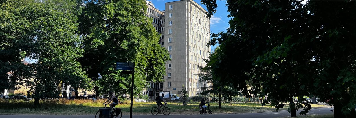
Starting your walk at Hassocks
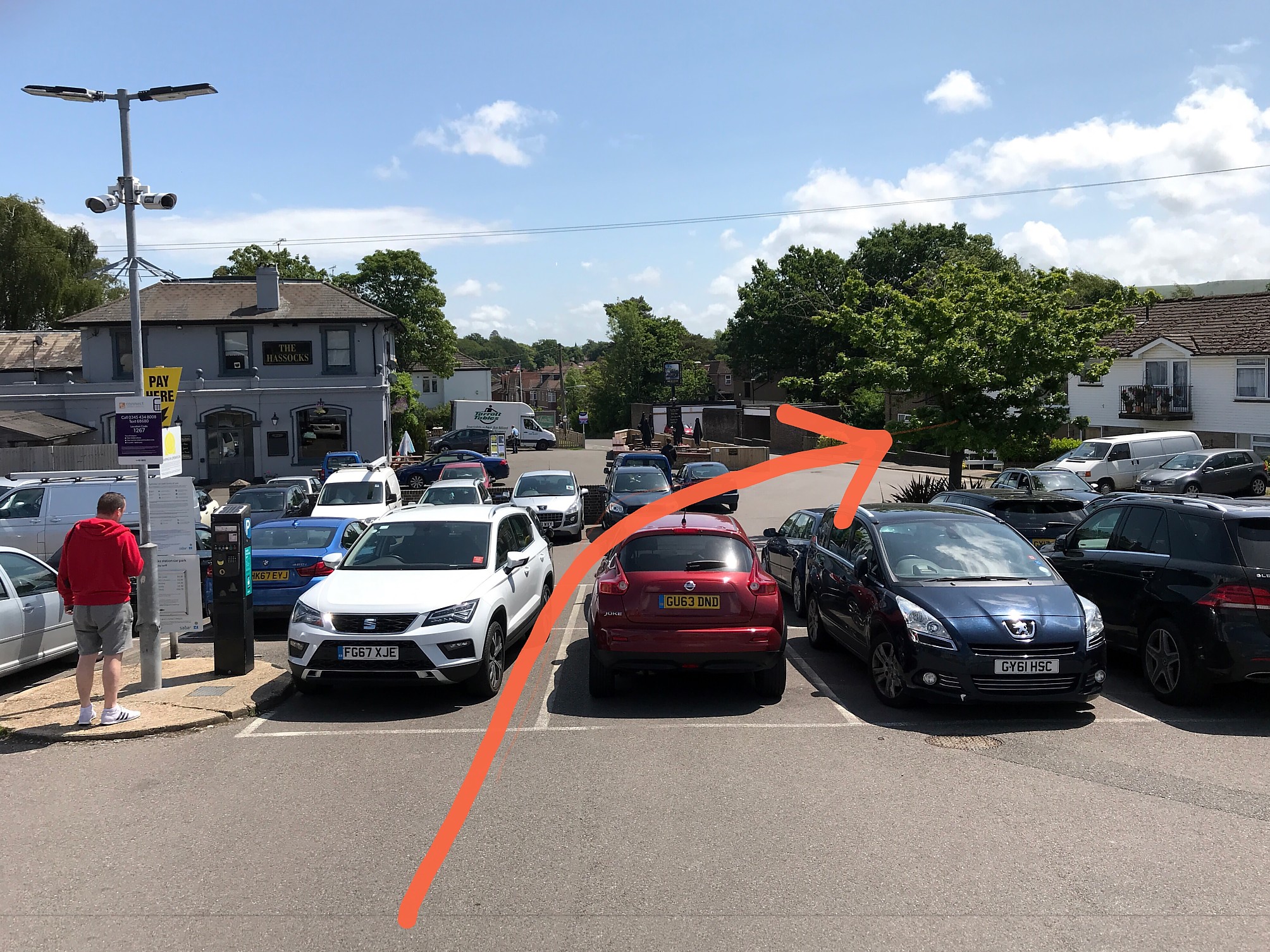
Exit Hassocks station from the southbound side, and walk across the car park to the right of The Hassocks pub. Look for the footpath sign at the end of the row of houses. Go down the path to the road and walk right towards the railway bridge.
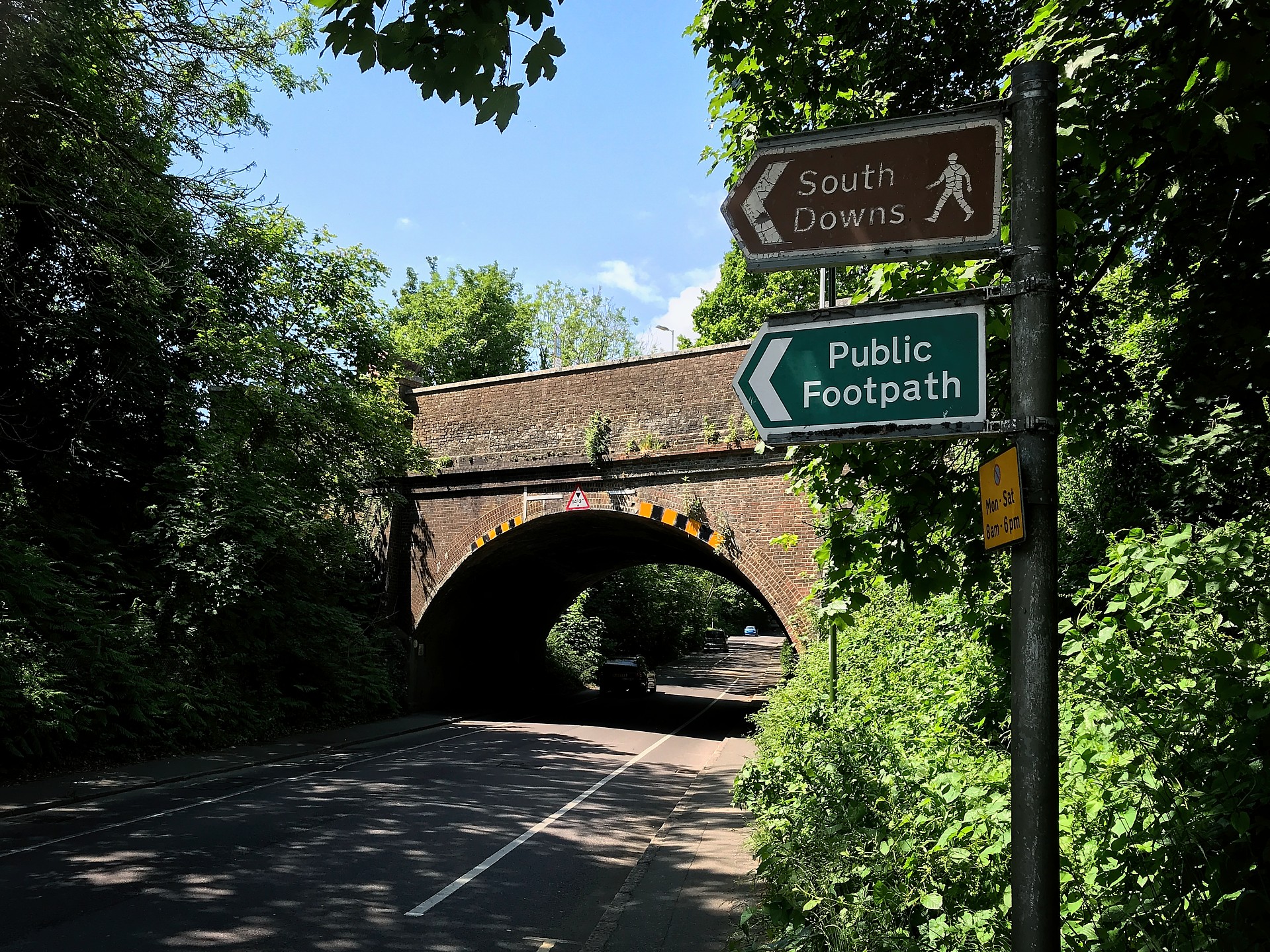
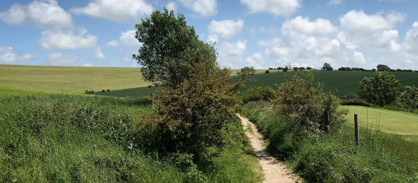
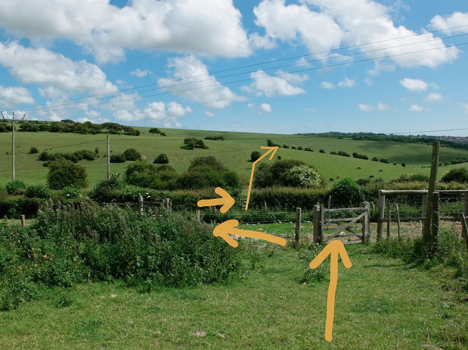
Take the footpath closest to the bridge and go up the steps to walk alongside the railway which is on your right. Keep walking for quite a while until, at the end of the woods on your left, you encounter a seat and a stile.
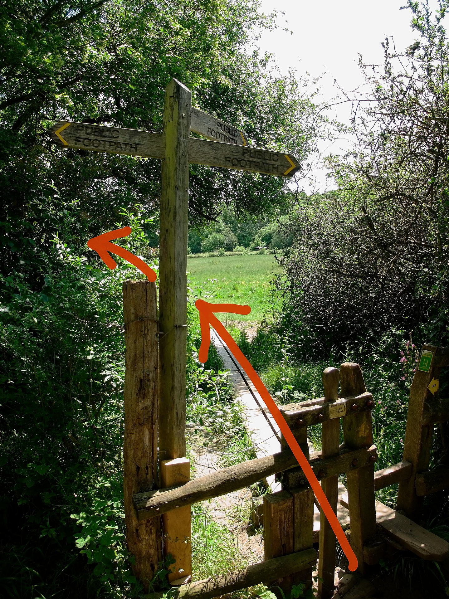
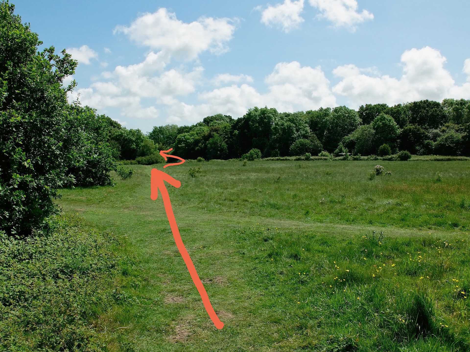
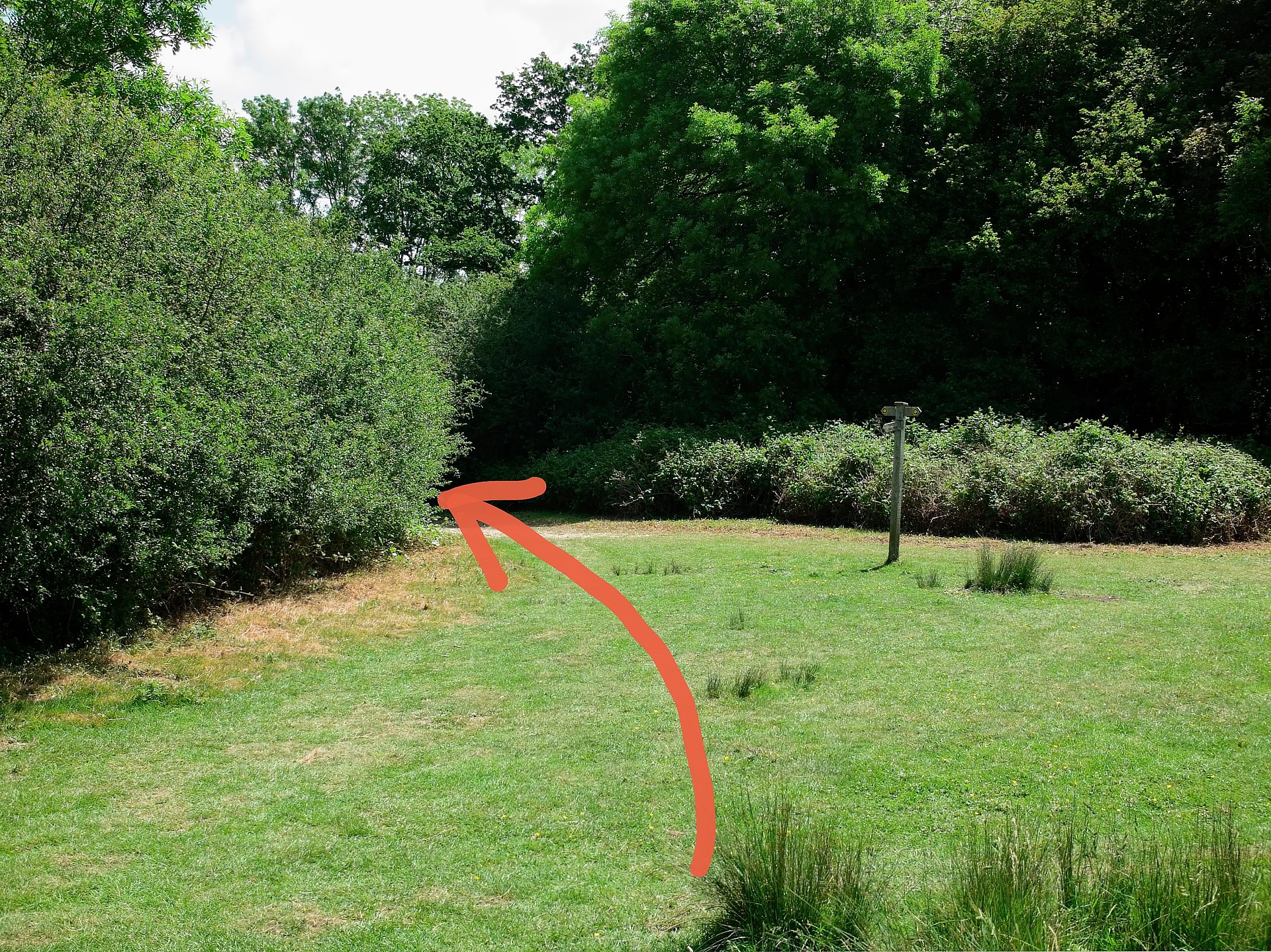
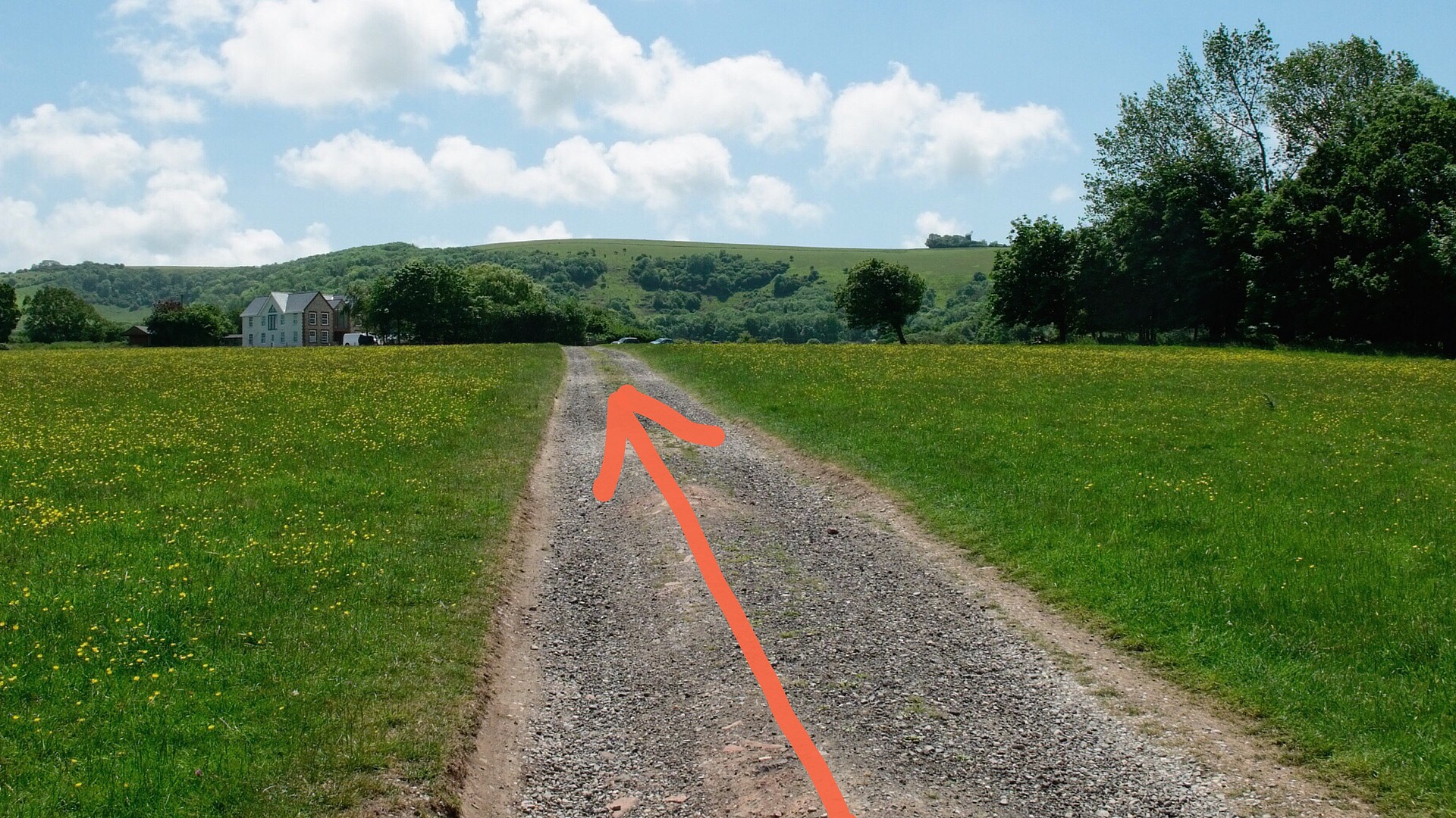
Go through the stile and following the line of the wooden boards go across the field and between the bushes after a footpath signpost.
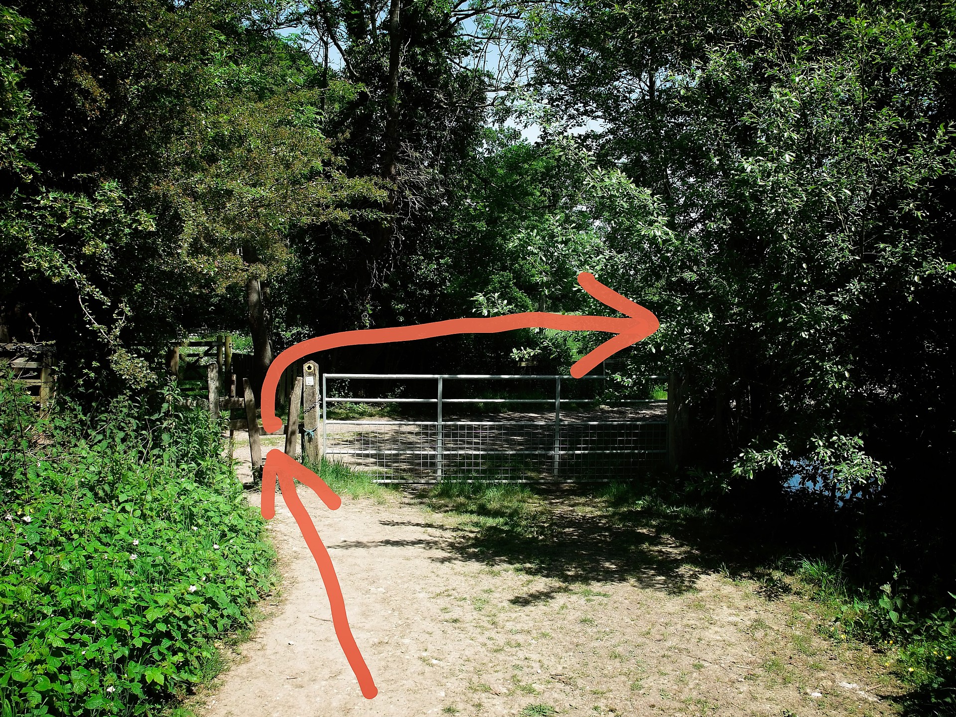
The path curves round to the left. Go slightly right round Woodbine Cottage to the metal gate. Go over the style by the gate and turn right along the unmade road.
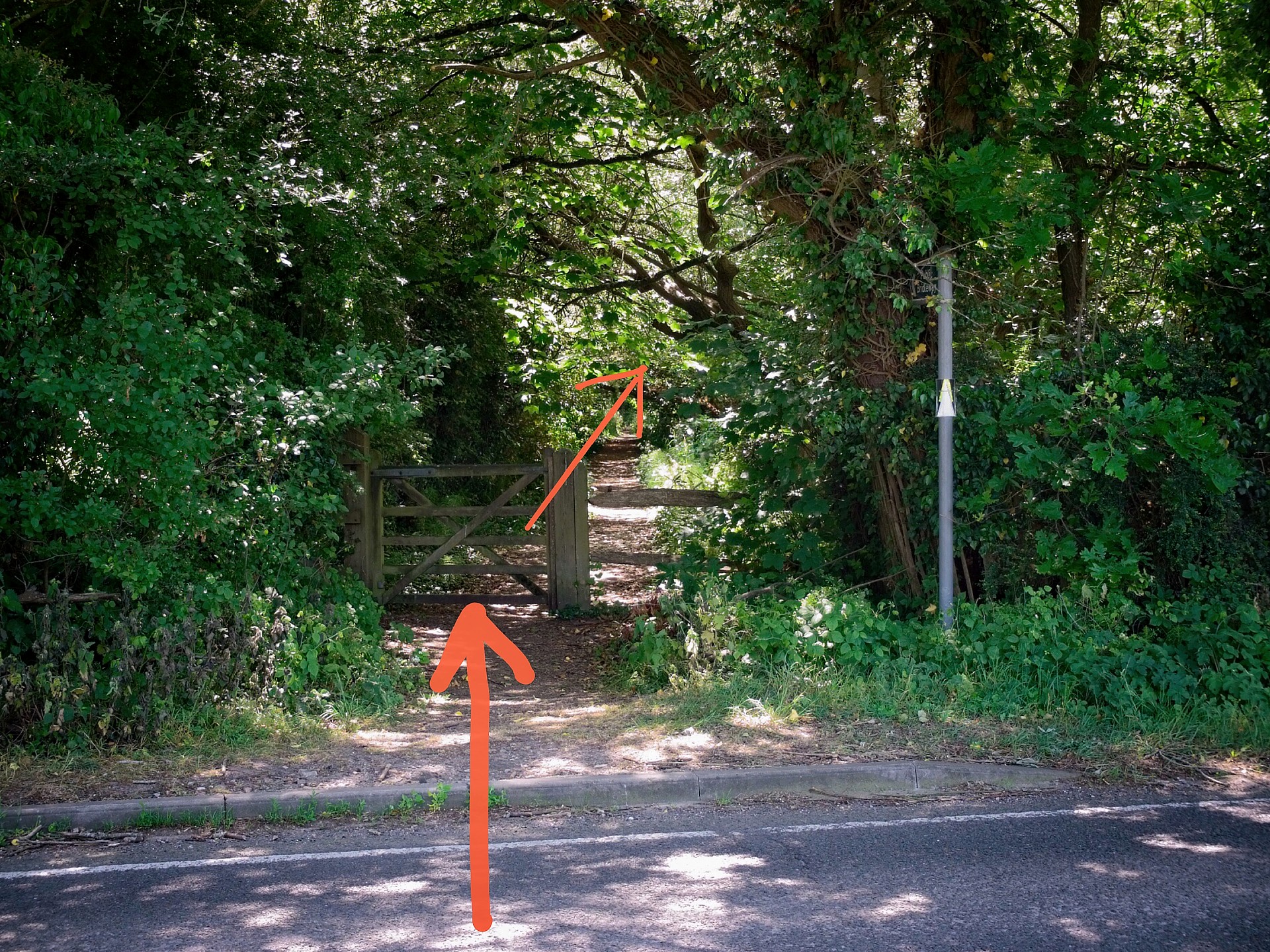
Soon you’ll see our first destination – two windmills on top of a hill. Follow the unmade road past a big house on your left to reach a country road. Cross the road and continue straight ahead on the bridleway underneath overhanging trees.
When you reach an old cottage go left at about 45˚then bear right on the long curving road through the houses. You are in Clayton.
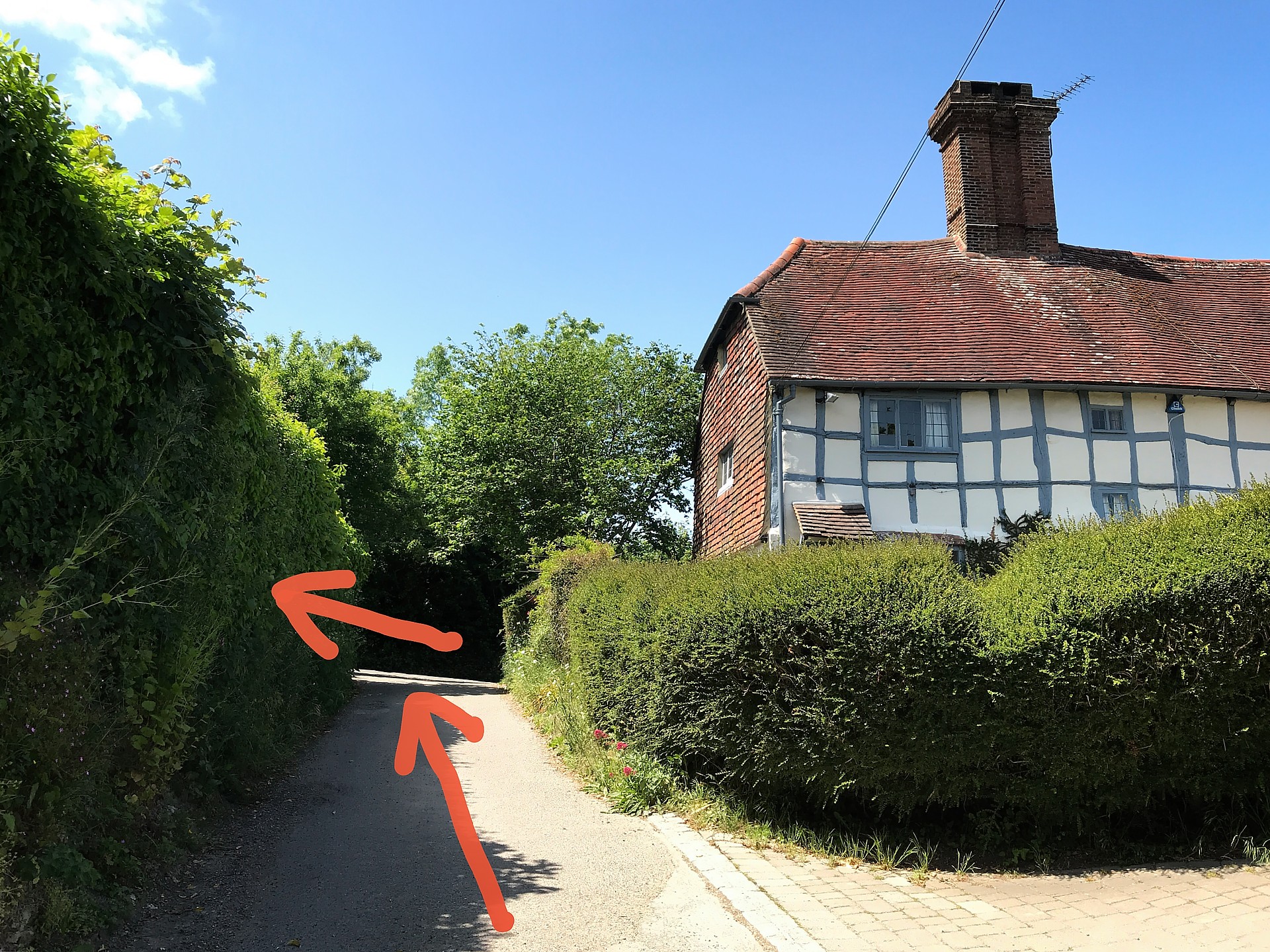
When you come to a T junction with a tarmac road by “Clayton Castle”, a Tudor looking house, turn left up the hill.

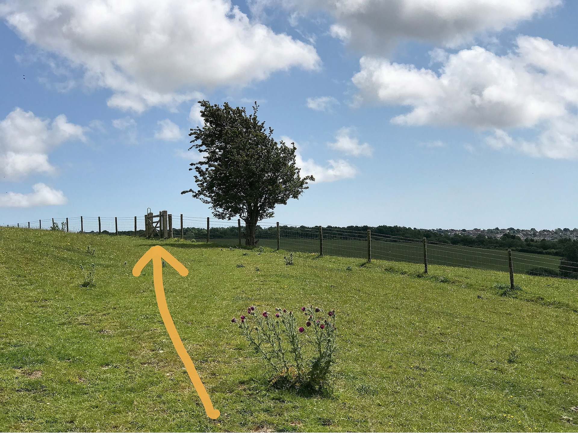
In a short while go sharp right up the footpath behind a piece of white fence. This is the steepest part of the walk. To walk on the Downs you first have to do the up bit. After a metal gate keep walking straight ahead up the well worn path. After the bushes go ahead towards a fence and footpath sign, then curve leftwards. A little zigzag is easier than going straight up the hill.
Take a little rest on your way up the hill and look back to enjoy the view. My photos can’t convey the wonderful feeling of being out and about in this landscape. You have to experience it.
Walk to the Clayton Windmills
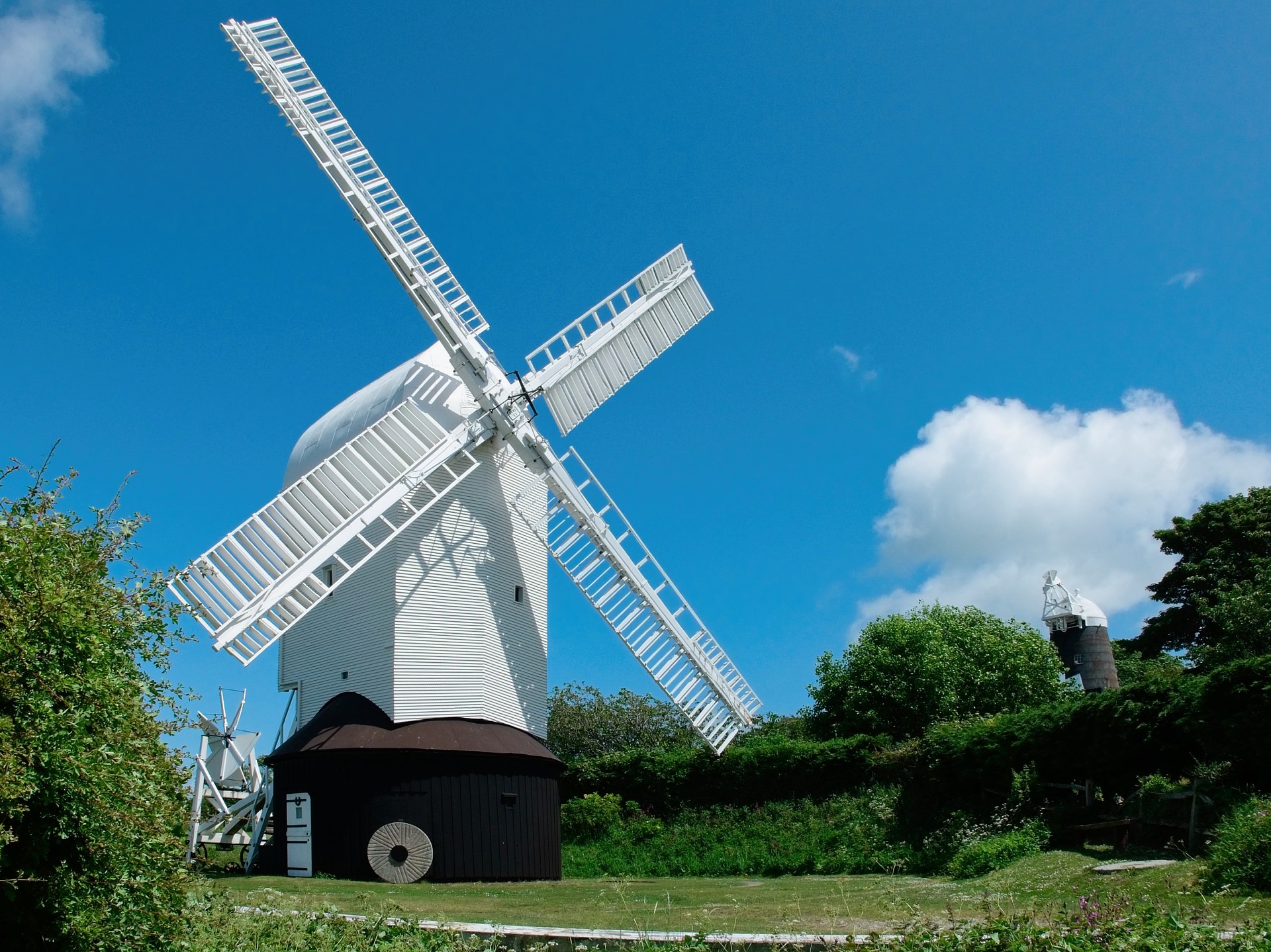
Walk to the right through the little car park to get a better view of the “Jill” windmill (the white one). It’s open to the public most Sunday afternoons (2-5pm) from May to Sept. The car park is often full. Read the history of both these windmills here. Jill is a restored and working corn windmill dating from 1821.
It might take you 1 hour 15 mins to walk to the Clayton windmills from Hassocks station.
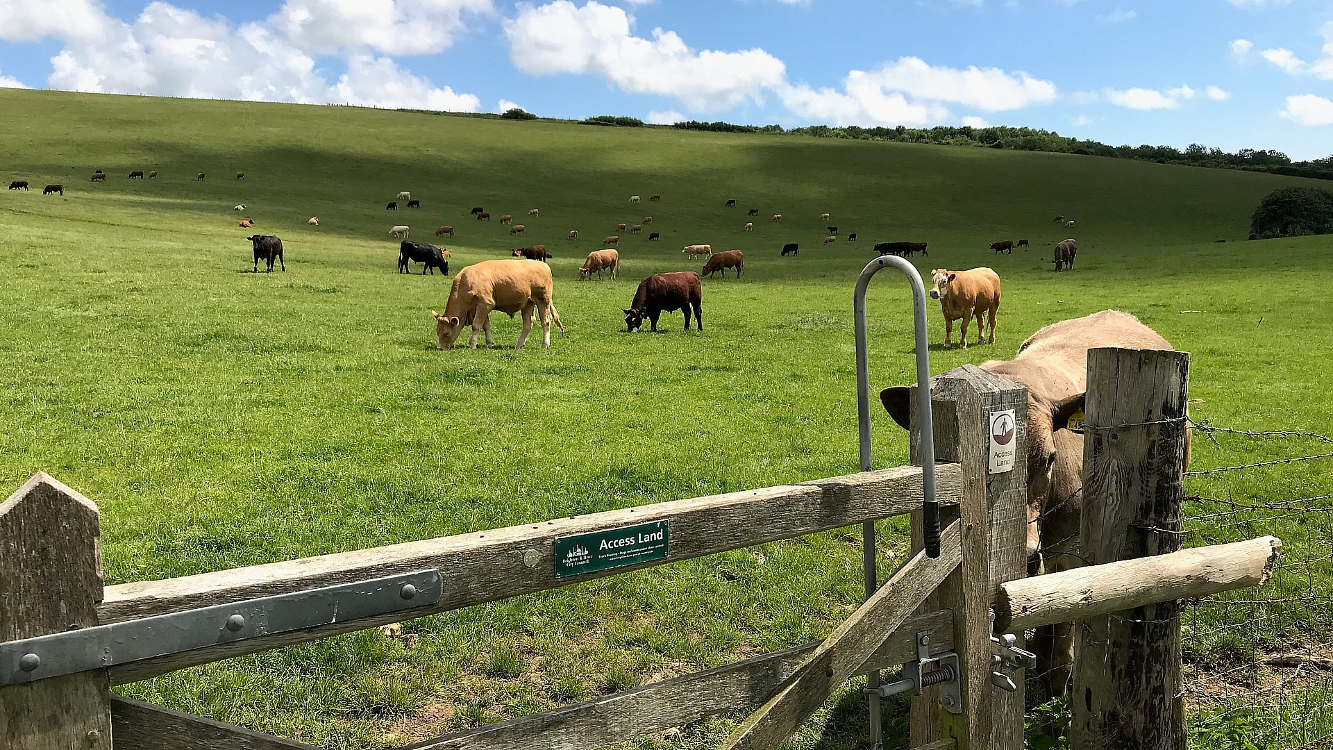
Encountering Farm Animals
The general idea is that if you don’t give them a hard time you won’t have any problems. Sheep will avoid you. Cows and calves will give way. Stick together, create your own little herd, it’s what they do. Don’t talk much and keep the volume down. Walk slowly, keep calm, and stop at times. Walk round them where possible. Sometimes you’ll find them blocking a gate. Just walk slowly towards them and they should move away. Bullocks will all stop and stare at you, but don’t let that intimidate you. Stand your ground and stop at times. Aggressive bulls are kept away from the footpaths, in their own fields.
Walking to the Chattri Memorial
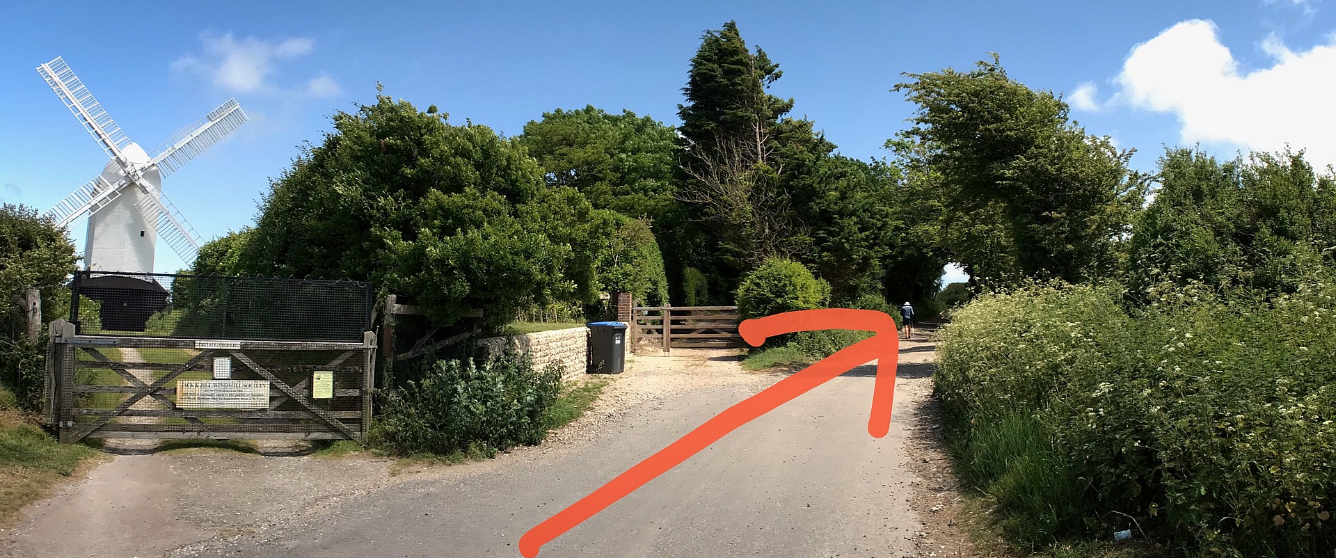
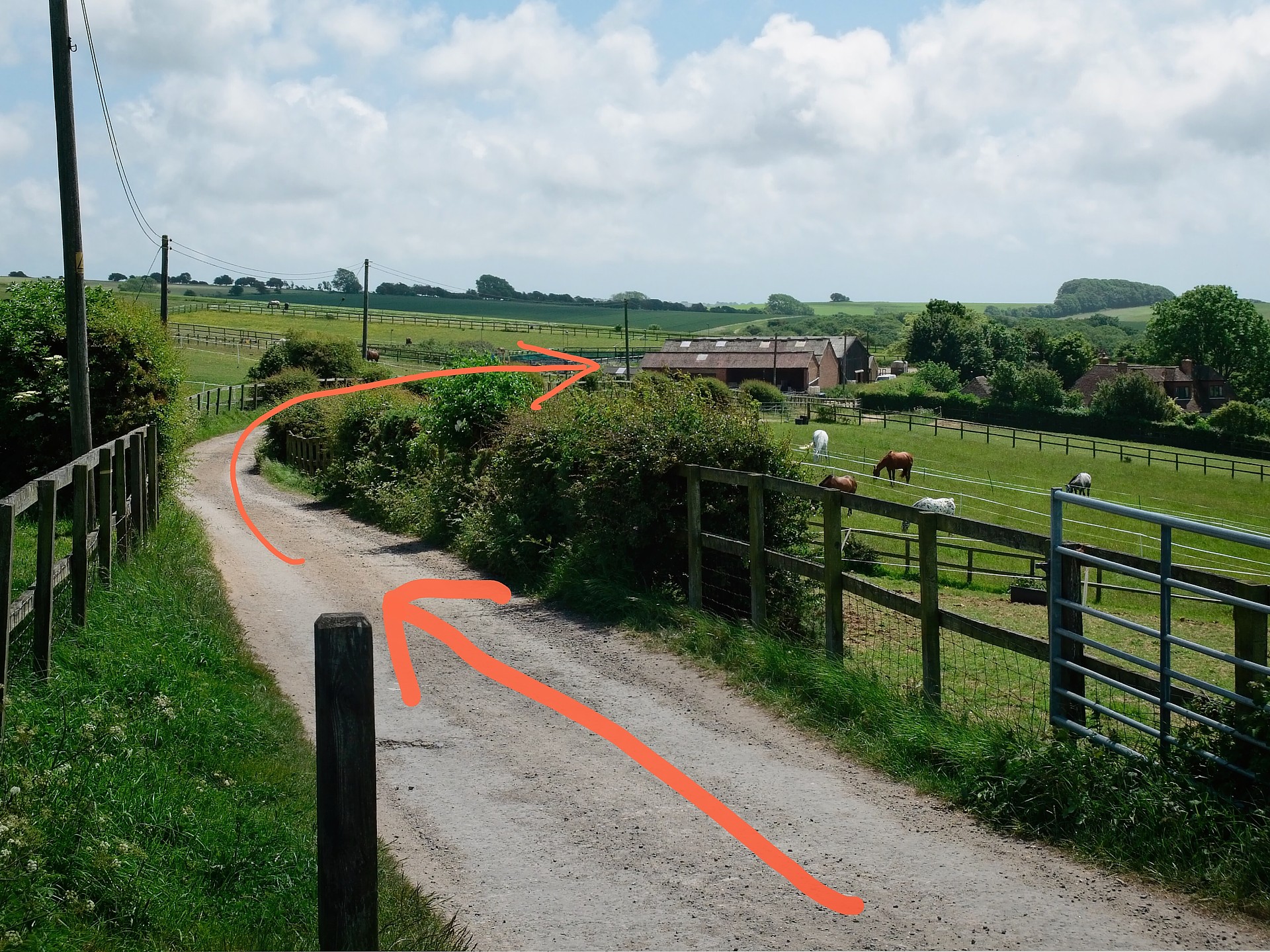
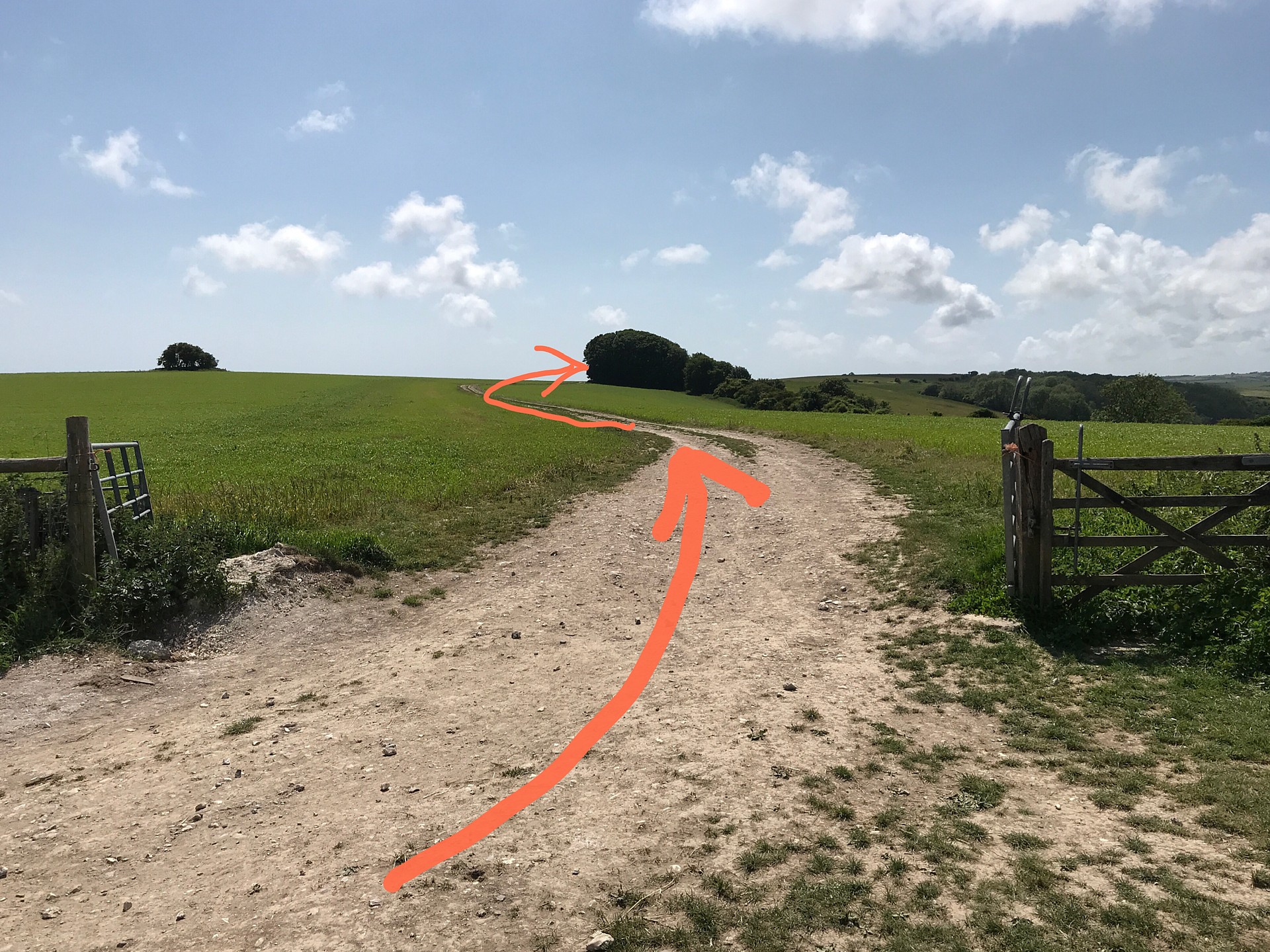
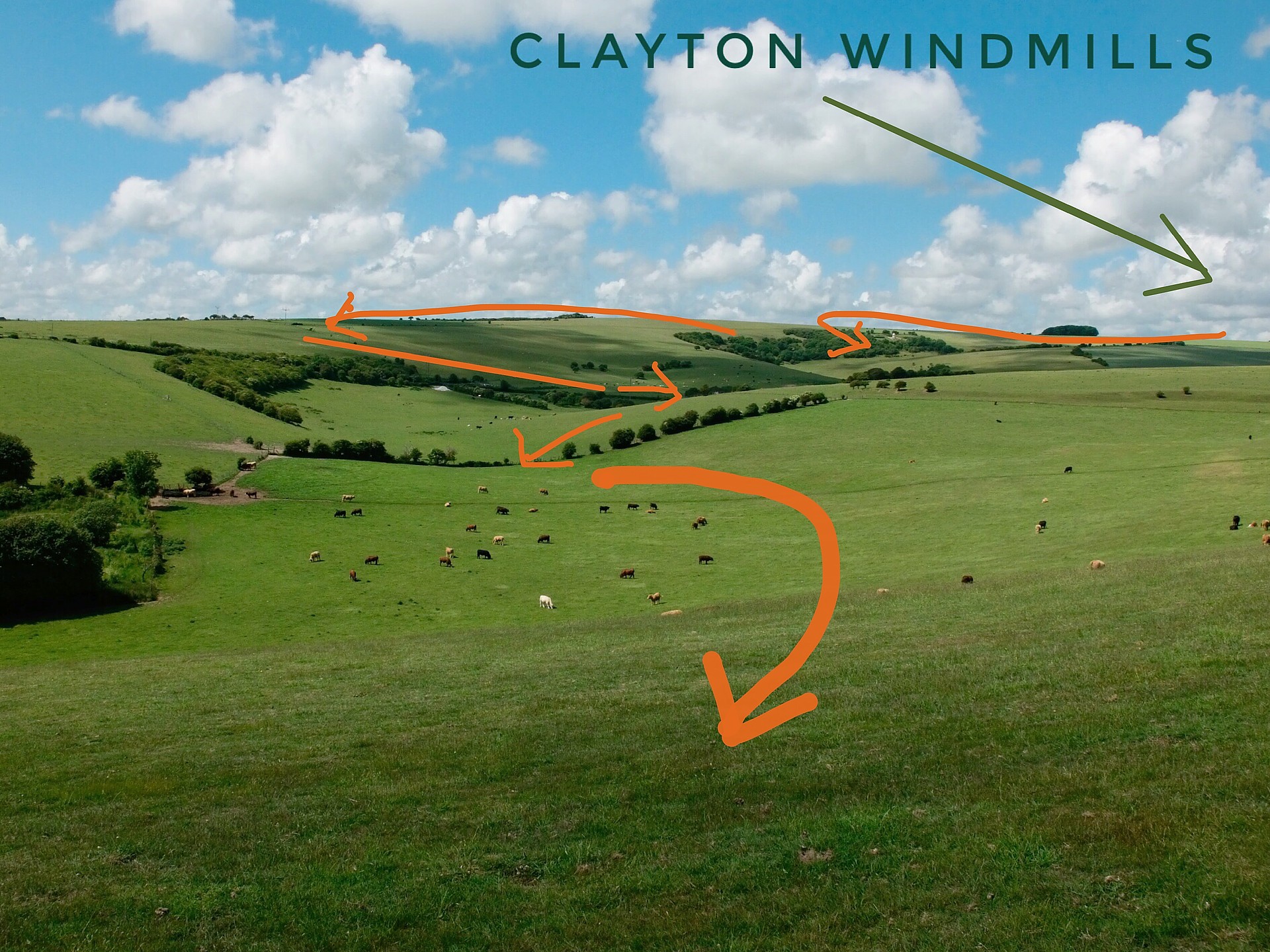
Exit the car park at the far end, past the entrance gate to “Jill” and up the road with the windmills on your left The brick built “Jack” windmill was built in 1866 to replace the former Duncton Mill and is occupied as a private house. Continue walking, you’ll soon come to a fork in the roads. Go right on the South Downs Way through a farm which keeps horses.
After you leave the farm buildings continue straight ahead, crossing another footpath. A sign post points to the Chattri War Memorial. That’s where you are going next. Now you’ll find yourself walking alongside a golf course. I have no idea how people get to this. At the bottom of a slope the path bends right round a pond in the corner of a golf course.
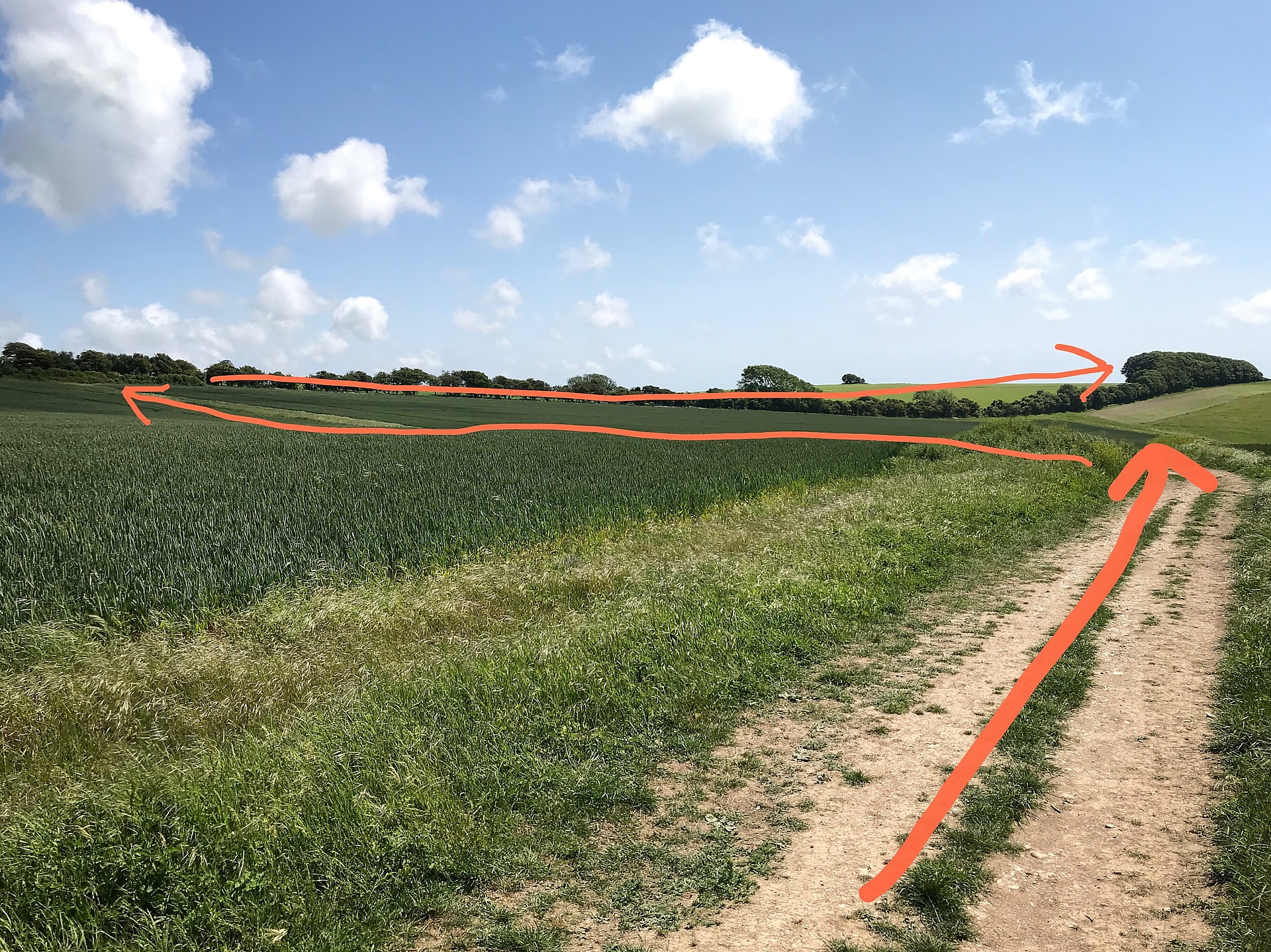
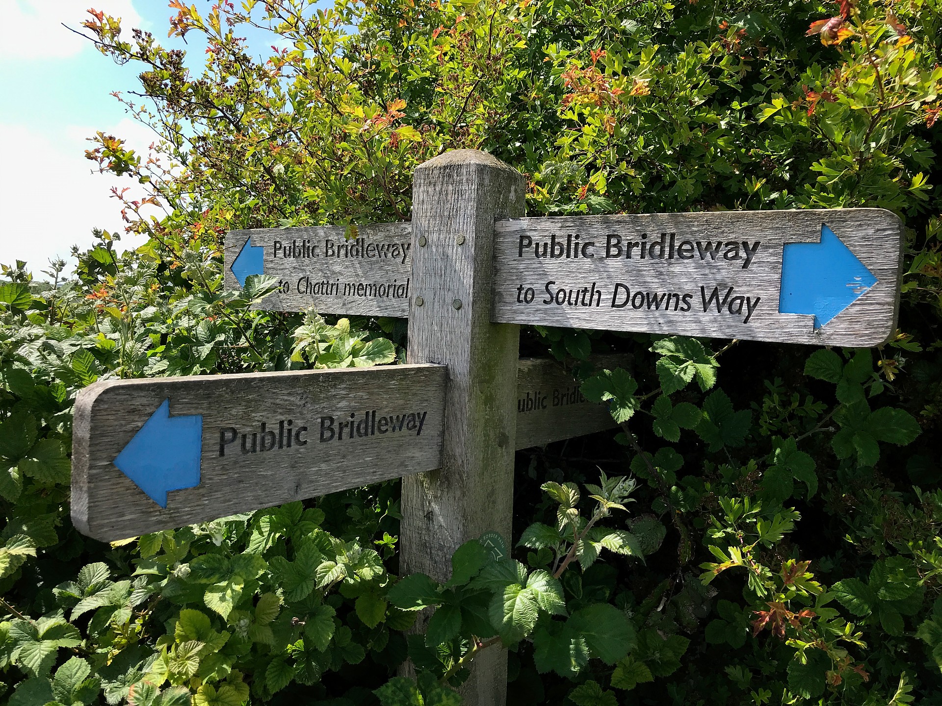
Just after a cattle trough the path comes to a T-junction with one of those signs which looks like it was put there to confuse WW2 German paratroopers. Go left along the edge of a field. At the top of the small hill go right along the line of the trees. Eventually the path goes left through a newish square shaped metal gate. When you reach the end of the hedge you’ll see another sign for the Chattri. Go right through an identical metal gate heading towards the big clump of trees.
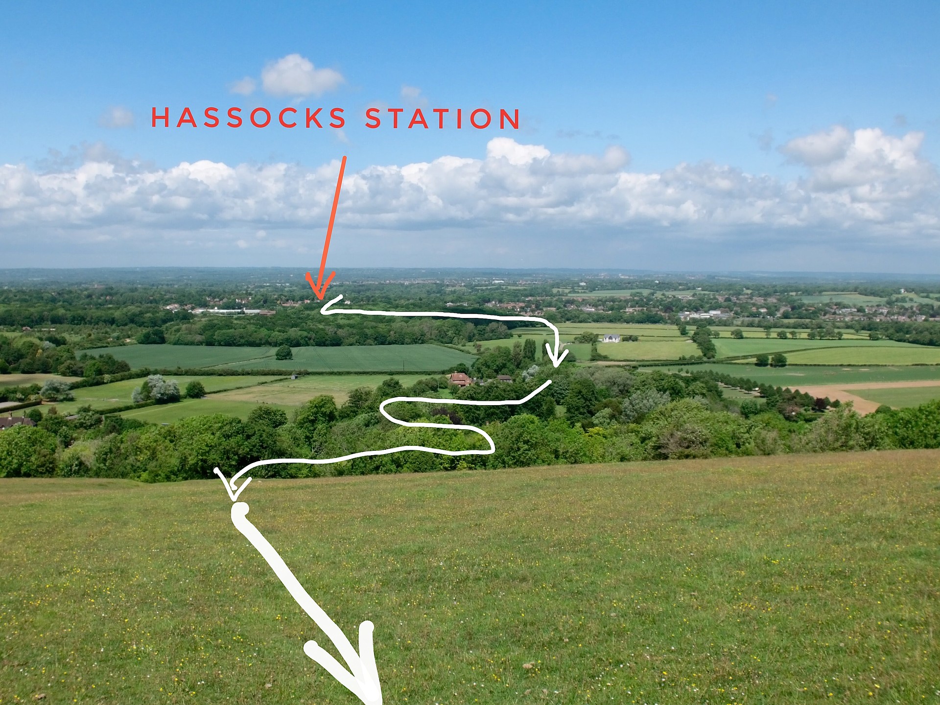
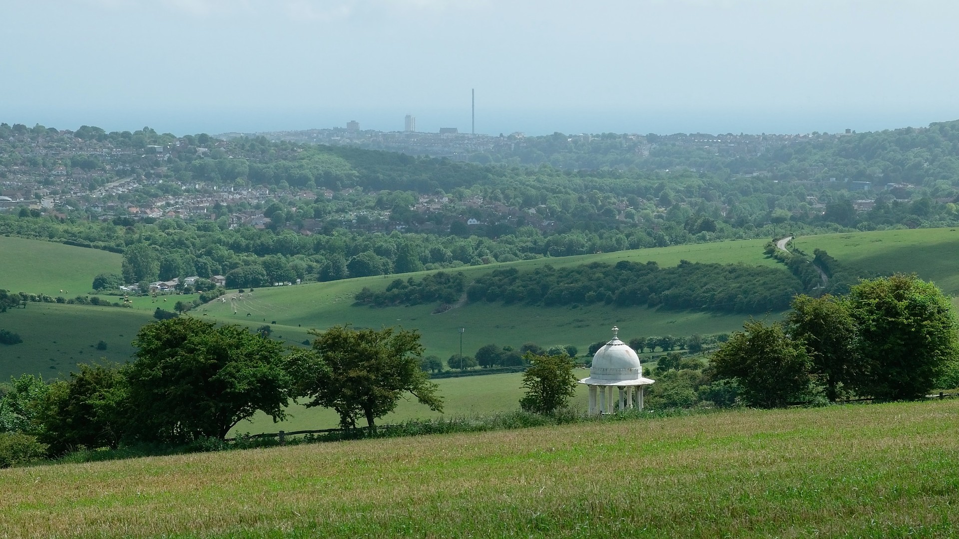
Stay on the path past the big clump of trees on your right. Look to your left and you’ll see Brighton in the distance and the pole of the i360 on the seafront.
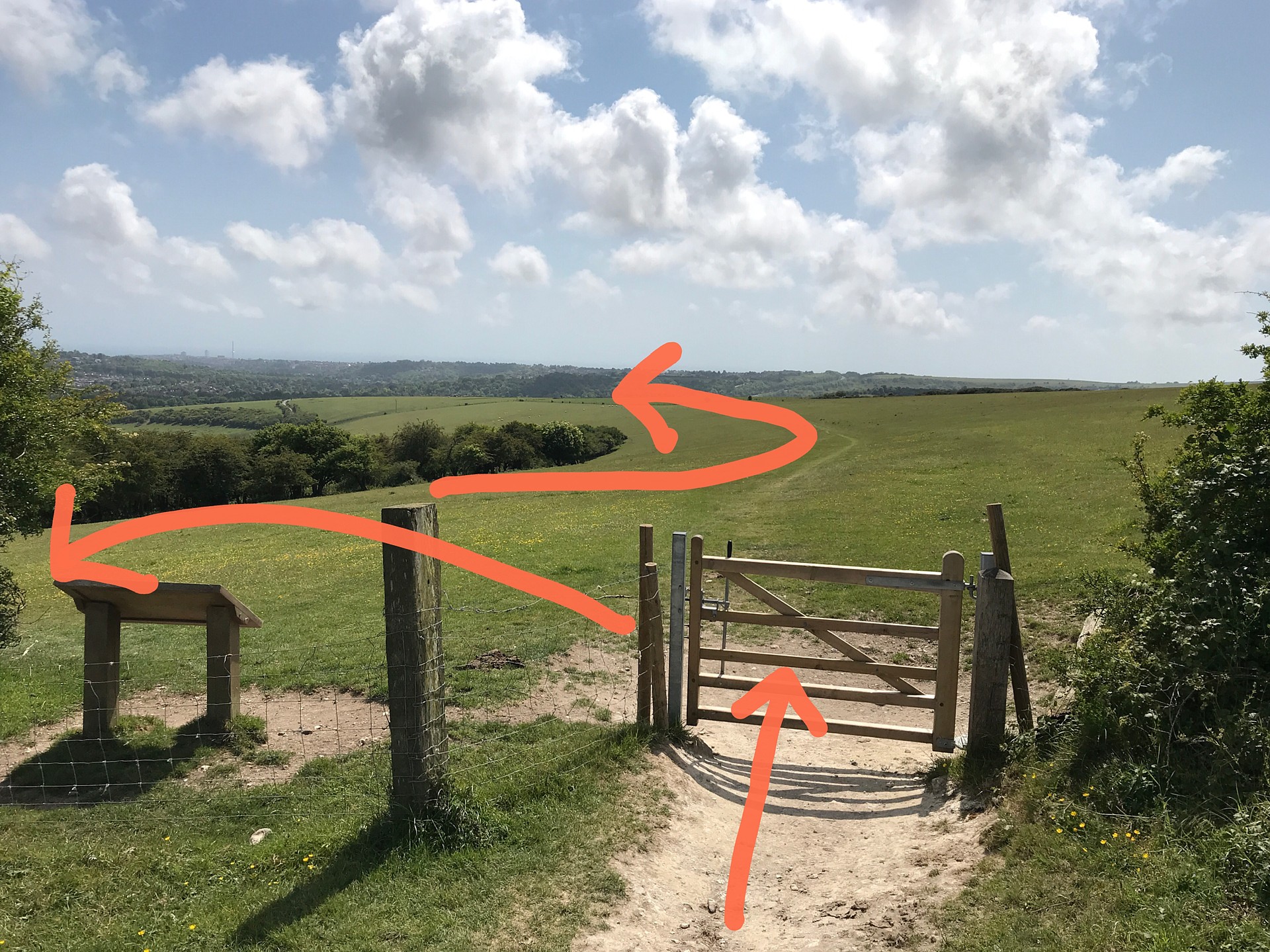
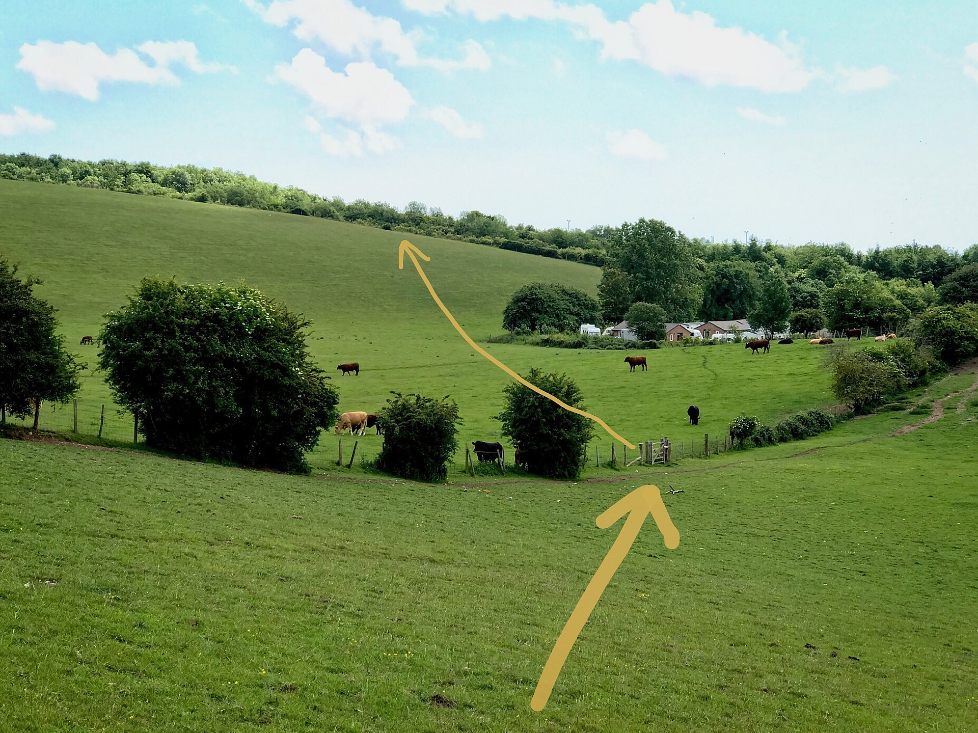
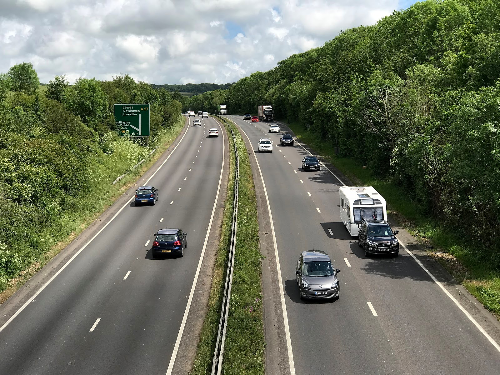
Soon you’ll reach a gate. There’s a map beside to it showing where you’ll be going next. You’ll be heading through Ewe Bottom to the green symbol of a footbridge at the bottom of the map. This is the only safe place near here to cross the A27.
Go sharp left after the gate and left though the 2nd gate down the hill to have a look at the Chattri memorial.
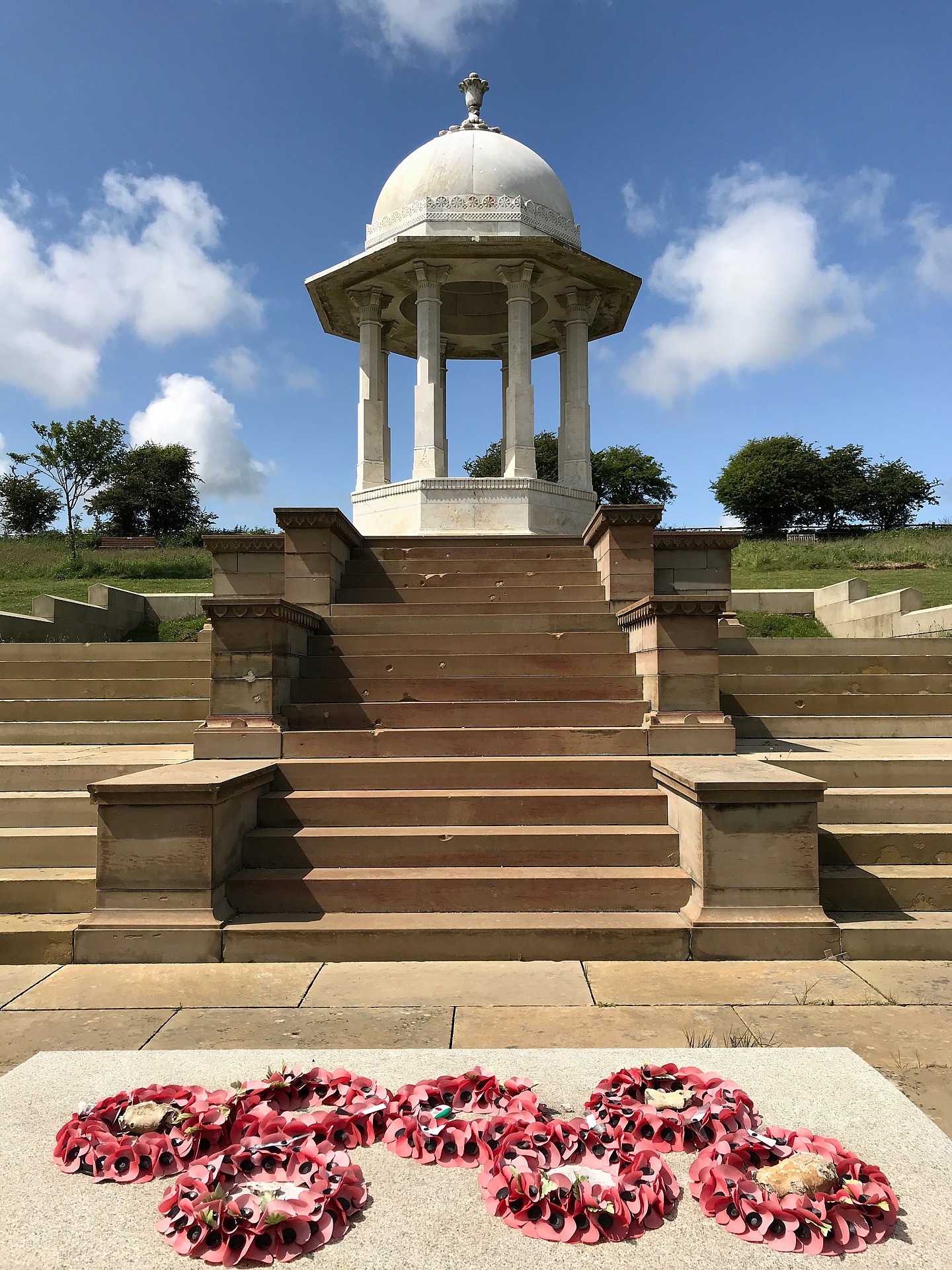
If you haven’t stopped for a picnic it might have taken you 2 1/2 hours to get here from Hassocks.
1.5 million Indian Army troops fought alongside British soldiers during WW1. An Indian Military Hospital was set up in the Royal Pavilion at Brighton. The Hindu and Sikh soldiers who died were cremated up here on the Downs. In 1921 this memorial was built.
Walking to Patcham on the edge of Brighton
Walk straight ahead back out of the Chattri gate and go slightly uphill to join the main path. You’ll be walking towards the i360. Walk straight past a wooden signpost pointing downhill to the left. We don’t want to go down there, It’s a firing range. They sometimes show red warning flags.
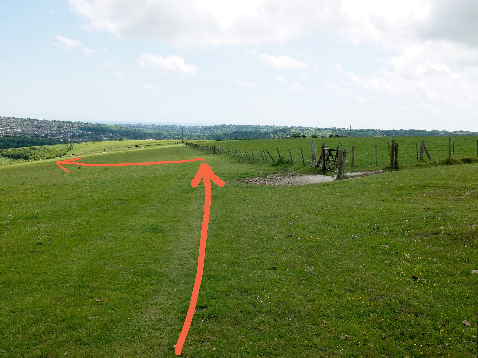
You’ll shortly be walking past a fence with a field on your right. At the 2nd gate in the fence, it’s not far, walk away from the fence downhill at about 70º to the way you were walking.
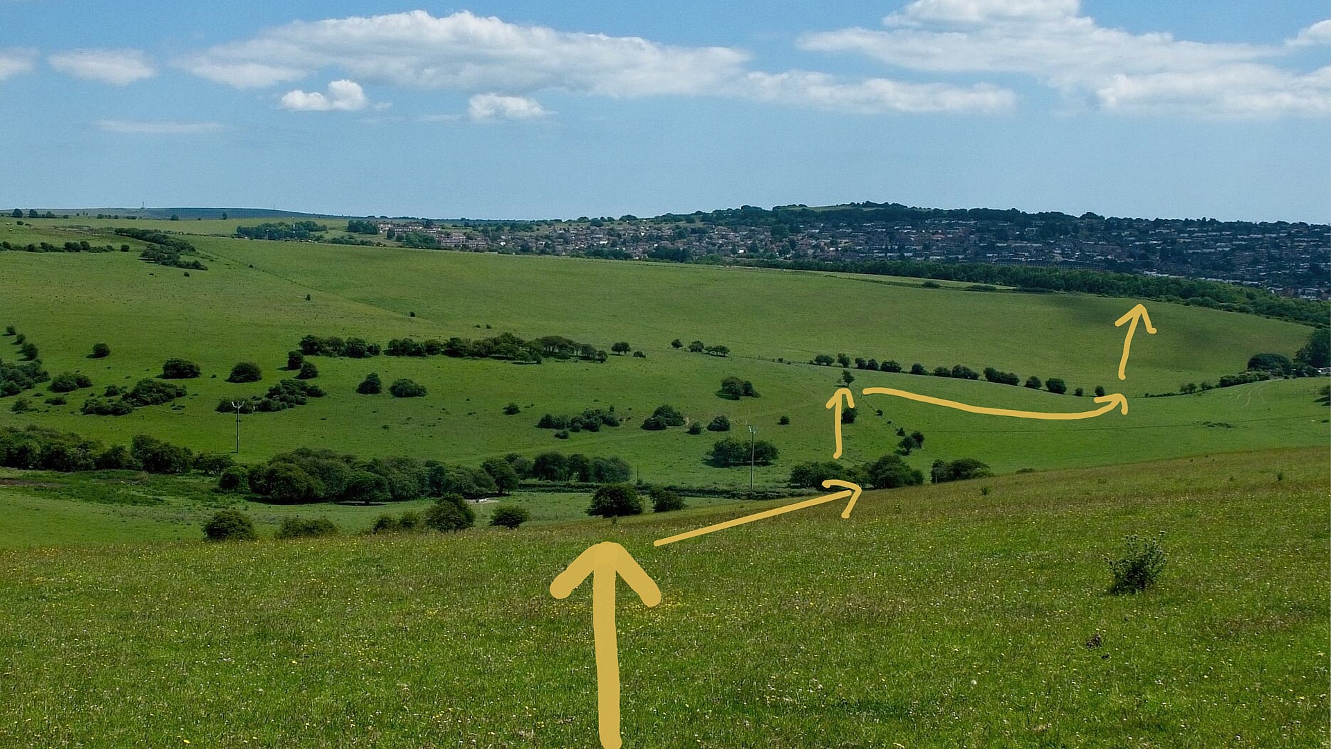
When you get about halfway down the hill you’ll see a metal gate alongside the road. It’s about 30º to the right. Head towards the right of the gate.
You’ll see some sheep pens in the bottom right corner of the field with some electricity cables on poles behind. You are heading to a gate left of, and next to the pens.
Walk roughly straight ahead through three gates in quick succession. Walk straight down through the middle of some bushes, then uphill to the left of the fence to a gate beside a small tree near the top of the fence.
Go though the gate marked “Access Land” and head about 60˚ left towards some caravans set in some trees. Before you get to them you’ll notice a gate in the left hand fence at the bottom of the dip. Go though that and walk uphill about 10º to your right towards the top left corner of the field. You’ll see the next gate.
Go through the gate, down the steps and sharp right down the lane, then immediately left across a footbridge over the A27 raceway.
Go right downhill, with the garden fences on your left. When the footpath opens out go left across a playing field past a children’s play area. Exit from the far left corner and you’ll come out facing the Ladies Mile Hotel – for a pitstop?
The walk from Hassocks Station to here might take you 3 hours. But it’s not a race, enjoy it.
By Bus to Brighton Pier
The bus which will take you through suburbia to Brighton Pier stops outside the pub. Both the 5 and 5A buses towards Hangleton will take you to “Old Steine” for the pier. There are 6 buses an hour Mon-Sat daytime and 4 per hour on Sundays. There’s an electronic indicator board here. I takes about 25 mins from here to the seafront.
This is Patcham Village. Old Patcham Village is to your right when you face the pub. The Ladies Mile was originally a drovers road. It gained its name as this was the northerly section of a pleasant circular country ride for Victorian horsewomen. The southern end was somewhere near Preston Park.
Patcham used to be a farming community quite separate from Brighton. In 1928 the Brighton boundary was extended up to here. The Ladies Mile Estate was developed in the 1930s by George Ferguson. The first thing to be built was the clock tower – as a sales aid.
Brighthelmstone was a fishing village, without a sea wall, which used to flood at times. It was peaceful until the Prince Regent (later King George IV) brought party time to Brighton in 1783. The cartoons of James Gillray and George Cruikshank of the Prince Regent are great fun.
At the Old Steine bus stop the pier is in front of the bus. There are good toilets at the far end. The Lanes are full of great and quirky bars and restaurants. At the seafront end they lie between East Street and West Street. To the north of North Street they continue between Prinny’s pleasure palace and Queens Road up to almost level with the Station.
If you do try this walk, please let us know how you got on by posting a comment below.
You might like to checkout our previous day trip by train from London to visit Britain’s WW2 codebreaking centre at Bletchley Park.
Thanks Joanna, it’s really kind of you to write in. Alan
We loved this walk on a beautiful late summer Sunday with clear blue skies and blackberries ripening. Great directions and a yummy Victoria Sponge at the Windmill Cafe which is open on Sunday afternoons. Thank you for helping some Londoners blow away the cobwebs.